Storm Ready®: Status Message
...loading current StormReady® status...
Current Conditions
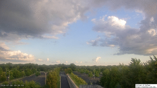
College of DuPage SkyCam
Current Local Radar
| Temperature | |
|---|---|
| 70°F | |
| Feels Like: | |
| 70°F | |
| Dew Point | Humidity |
| 70°F | 100% |
 Mostly Cloudy
| Wind Strength | ||
|---|---|---|
| Light | Moderate | Strong |
| Northeast at 1 mph | ||
Local Graphical Forecast (Updated: 07/04/24 3:26 am)
| Thursday (7/4) | |
|---|---|
| Day | Night |
 |
|
|
|
|
| High | Low |
| 88 | 70 |
| Friday (7/5) | |
|---|---|
| Day | Night |
 |
|
|
|
|
| High | Low |
| 80 | 63 |
| Saturday (7/6) | |
|---|---|
| Day | Night |
 |
 |
| High | Low |
| 80 | 64 |
| Sunday (7/7) | |
|---|---|
| Day | Night |
 |
|
|
|
|
| High | Low |
| 84 | 67 |
| Monday (7/8) | |
|---|---|
| Day | Night |
|
|
|
|
|
| High | Low |
| 84 | 66 |
| Tuesday (7/9) | |
|---|---|
| Day | Night |
 |
|
| High | Low |
| 82 | 64 |
| Wednesday (7/10) | |
|---|---|
| Day | Night |
| High | Low |
| 83 | |
Detailed Text Forecast (Updated: 07/04/24 3:26 am)
Thursday: A chance of showers, with thunderstorms also possible after 3pm. Partly sunny, with a high near 88. Calm wind becoming south southeast around 5 mph in the afternoon. Winds could gust as high as 10 mph. Chance of precipitation is 30%.
Thursday Night: A chance of showers and thunderstorms, then showers likely and possibly a thunderstorm after 1am. Mostly cloudy, with a low around 70. Southeast wind 5 to 10 mph. Chance of precipitation is 60%. New rainfall amounts between a tenth and quarter of an inch, except higher amounts possible in thunderstorms.
Friday: A 30 percent chance of showers and thunderstorms, mainly after 1pm. Partly sunny, with a high near 80. Breezy, with a west southwest wind 10 to 20 mph, with gusts as high as 30 mph.
Friday Night: Mostly cloudy, with a low around 63. West wind 10 to 15 mph, with gusts as high as 25 mph.
Saturday: Mostly sunny, with a high near 80. West northwest wind around 10 mph, with gusts as high as 15 mph.
Saturday Night: Mostly clear, with a low around 64.
Sunday: A 20 percent chance of showers and thunderstorms after 1pm. Mostly sunny, with a high near 84.
Sunday Night: A chance of showers and thunderstorms. Mostly cloudy, with a low around 67.
Monday: A chance of showers and thunderstorms, then showers likely and possibly a thunderstorm after 1pm. Partly sunny, with a high near 84.
Monday Night: A chance of showers and thunderstorms before 1am. Mostly cloudy, with a low around 66.
Tuesday: A chance of showers and thunderstorms. Mostly sunny, with a high near 82.
Tuesday Night: Partly cloudy, with a low around 64.
Wednesday: A chance of showers and thunderstorms. Mostly sunny, with a high near 83.
COD Weather Statistics
COD Weather Station Statistics
- Time of Observation: 7/04/24 - 4:46:58 am
- Latitude: 41.89°N
- Longitude: -88.15°W
- Elevation: 747.63 ft
- Sunrise: 5:21am
- Sunset: 8:32pm
Current Weather Conditions
- Currently: Mostly Cloudy
- Visibility: 9.78SM
- Present Weather:
- Cloud Cover: Mostly Cloudy
Temperature and Pressure
- Air Temperature: 70.38°F
- Dewpoint Temperature: 70.32°F
- Wet-Bulb Temperature: 70.36°F
- Humidity: 99.81%
- Wind Chill:
- Heat Index:
- Pressure: 1012.19mb
Precipitation and Wind
- Current Precipitation: N/A
- Measured Liquid Precipitation: 0.00 Inches
- Current Wind: From the NE at 0.79mph
- Recent Peak Wind Gust: 1.31mph at 4:45am
Recent Station Records
- Highest Temperature (Today): 74.50°F
- Lowest Temperature (Today): 70.21°F
- Highest Relative Humidity (Today): 99.81%
- Lowest Relative Humidity (Today): 79.19%
- Highest Pressure (Today): 1014.9mb
- Lowest Pressure (Today): 1012.19mb
- Measured Liquid Precip (Today): 0.00 Inches
- Measured Liquid Precip (Month): 0.03 Inches
- Measured Liquid Precip (Year): 5.51 Inches
- Peak Wind Gust (Today): 6.79mph at 1:13am
 824
824  471
471  960
960